The automated Import coordinates page is available for GeoMoS Now! Survey Edition users after a successful log in as an Administrator. It can be configured and activated in the project inside the Project management.
The automated import allows the user to automatically import the coordinates that are measured and sent from the total station by using the Captivate TPS Monitoring application. The data is automatically added to the GeoMoS database.
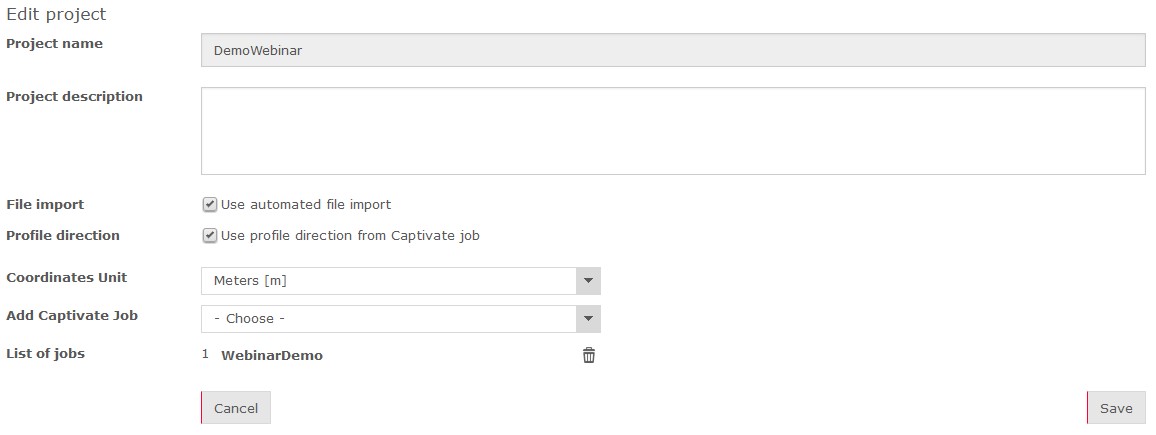
The automated import can be activated when editing a project in Project management.
On the project management page, an active file import is indicated with
a file icon ![]() .
.