Import coordinates (manually)
The Import coordinates page is available for GeoMoS Now! Survey Edition
users after a successful log in as an Administrator or an Editor. It can
be accessed either by clicking on the Import
coordinate button right after the log in, or from the left hand
menu at any time.

|
Only the GeoMoS Now! On-premises
users can use in parallel classic and Survey Edition. This is
because their monitoring data, be it from GeoMoS Monitor or from
direct file import, will be written to the same database. This
is why they do not need a special subscription license if they
want to add Survey Edition to their classic GeoMoS Now! service. |
Import coordinate page allows the user to import the measurement coordinates
from total station or digital
level directly from the file system. Additionally, the measurement
data can also be sent directly from field from total station that support
TPS monitoring application. Those data files will be then shown in the
table on Import coordinates page.
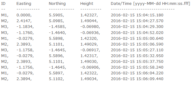
Data
The data that is to be imported in GeoMoS Now! has to be in ascii or
.csv data format with the following structure:
All imported files will be listed in the table on the Import coordinates
page. The files that have been sent directly from TPS monitoring app on
board the Captivate and SmartWorx total stations will be also listed here
with the following name: <date>_<time>_<jobname>.txt.
User can click on the file to download it and store it in the file system.
To upload new measurement file click on the Upload
new file link on the top of the table.
The Administrator will see all uploaded files, even if the Editor has
uploaded them. The Editor will see only the files he has uploaded.
The data listed in the Import coordinates table are not yet added to
the project view. To do so, select the file by clicking on the check box,
select the units for the measurements in the file and click on the Next
button.
Once the file has been added to GeoMoS Now! project, it will be deleted
from the list.
Data management
Before the data have been added to the GeoMoS database, they can be
verified by the user. All measurements in the file that has been selected
for import will be listed in the table.
The files can contain multiple measurements for the same point. The
first available epoch for the point will be selected as the null measurement.
This measurement will be marked with icon  . To select
the other measurement as a null measurement, click on the empty icon at
the beginning of the row.
. To select
the other measurement as a null measurement, click on the empty icon at
the beginning of the row.
The null measurement will serve to calculate the displacement for all
other measurements. This displacement will be checked and if the blunder
check does not pass, the measurements will be marked in red and the line
will get the outlier  icon. The
settings for the blunder check can be changed in the Settings
menu on the top of the page.
icon. The
settings for the blunder check can be changed in the Settings
menu on the top of the page.
Each measurement can be manually manipulated using the edit icon, or
deleted using the delete icon.
On the top of the table click on the Show
all data button to show also the data that has already been imported
to database. Those data will not have the file  icon.
icon.
Confirm the import with Finish button. All existing content in the project
view (graphs, reports, etc.) will be updated with the new measurements.
If this is a new project view, several pre-configured graphs will be created
on the Dashboard. These graphs can be modified or deleted and additional
content can be added to the project view.