Information on this page is valid only for the GeoMoS Now! On-premises system. The referencing procedure of a background image for vector and contour graphs is currently only possible with the assistance of the monitoring support team. You need to have an access to the computer where the GeoMoS Now! was installed.
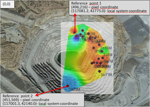
For georeferencing an image, you need to know the coordinates of at least two points from the image. That can be coordinates of the grid if you have a topographic map or the coordinates of two sensors and their position on the image (like in the example below).
The link between points in image (pixel) coordinates and destination coordinates needs to be stored in an xml file located here (if it doesn't exist, it has to be created manually):
C:\Leica Geosystems\GeoMoS\GeoMoSNow\GeoMoSNow_background_definition.xml
Copy the image here: C:\Program Files (x86)\Leica Geosystems\GeoMoS Now\Bin
Edit the xml file in any text editor
<?xml version="1.0" encoding="utf-8" ?>
<Images>
<Image name="Mine" source="Map_for_tps1.jpg">
<RefPoint x="117081.2" y="42775" pixelx="496" pixely="216" />
<RefPoint x="117001.3" y="42140" pixelx="451" pixely="569" />
</Image>
</Images>
The image and its reference is named “Mine”. This is the name that can be used in any of the GeoMoS Now! projects.
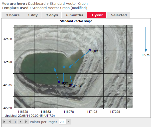
Open the Graph Designer, drag in Vector graph template, and select the Edit template icon.
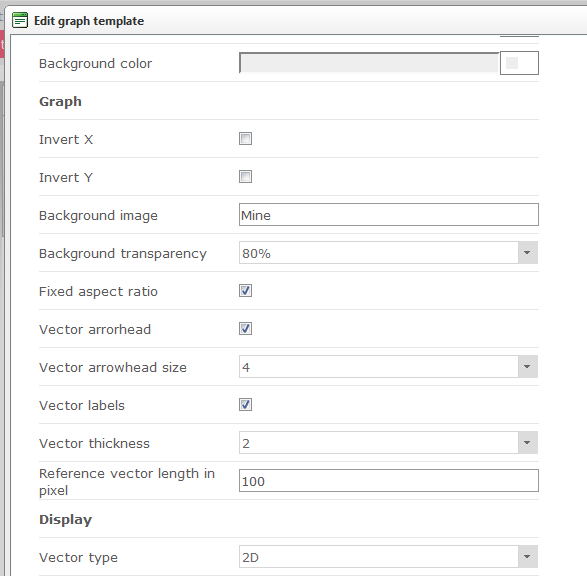
Enter the name of the picture – Mine and press OK.
The image will appear in the graph area.